Global Superfloods and the Lost World
by Graham Hancock

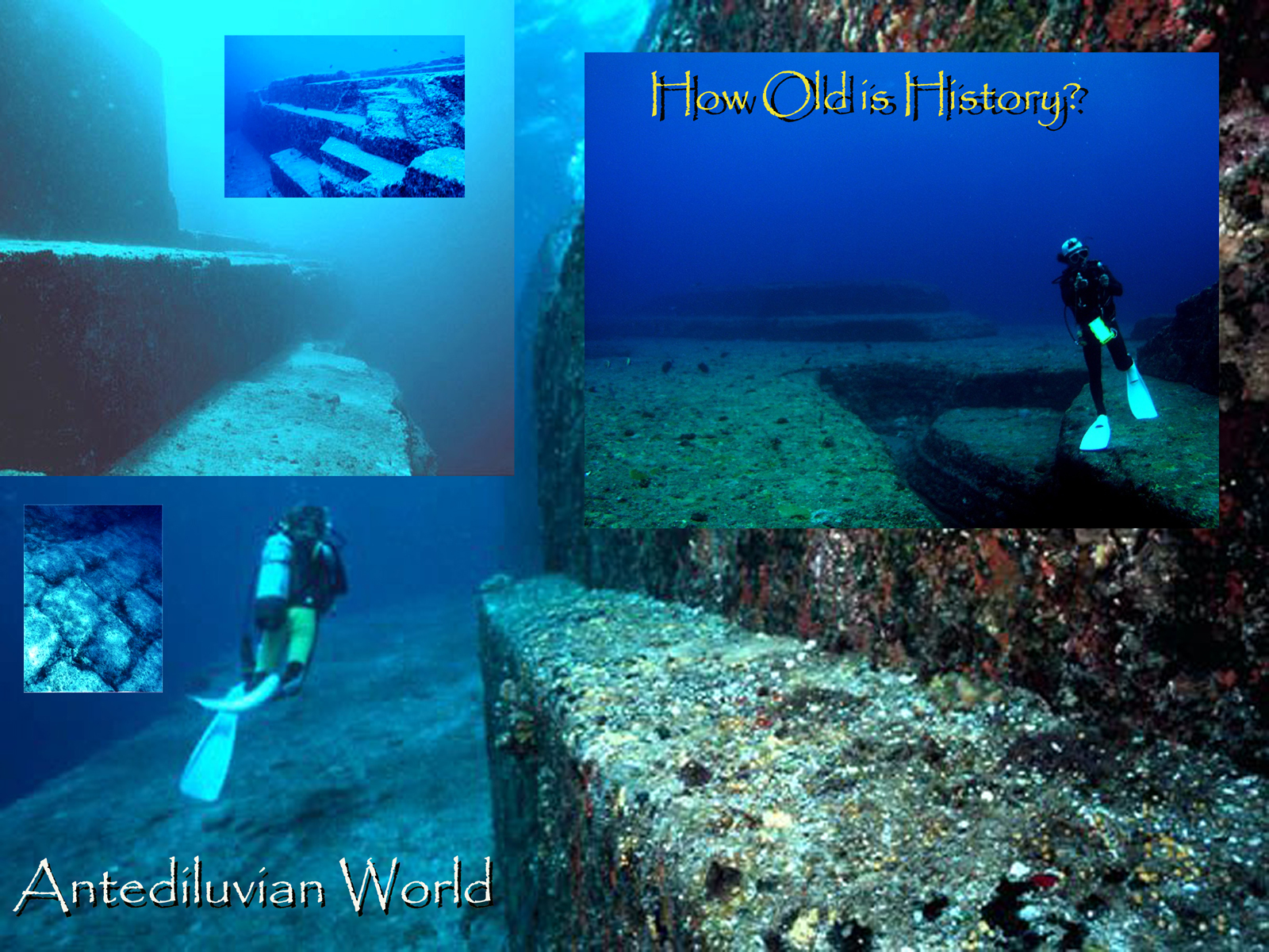
Worldwide,
we know that the period of 14,000 to 13,000 years ago, which coincides with the peak of
abundant monsoonal rains over India, was marked by violent oceanic flooding -
in fact, the first of the three great episodes of global superfloods that
dominated the meltdown of the Ice Age. The flooding was fed not merely by rain
but by the cataclysmic synchronous collapse of large ice-masses on several
different continents and by gigantic inundations of meltwater pouring down
river systems into the oceans. (124)
What
happened, at around 13,000 years ago, was that the long period of uninterrupted
warming that the world had just passed through (and that had greatly
intensified, according to some studies, between 15,000 years ago and 13,000
years ago) was instantly brought to a halt - all at once, everywhere - by a
global cold event known to palaeo climatologists as the 'Younger Dryas' or
'Dryas III'. In many ways mysterious and unexplained, this was an almost
unbelievably fast climatic reversion - from conditions that are calculated to
have been warmer and wetter than today's 13,000 years ago, to conditions that
were colder and drier than those at the Last Glacial Maximum, not much more
than a thousand years later.
From that
moment, around 12,800 years ago, it was as though an enchantment of ice had
gripped the earth. In many areas that had been approaching terminal meltdown
full glacial conditions were restored with breathtaking rapidity and all the
gains that had been made since the LGM were simply stripped away…(124)
A great, sudden extinction took place on the planet, perhaps as
recently as 11,500 years ago (usually attributed to the end of that last ice
age), in which hundreds of mammal and plant species disappeared from the face
of the earth, driven into deep caverns and charred muck piles the world over.
Modern science, with all its powers and prejudices, has been unable to
adequately explain this event. (83)

...the Russian scientist Immanuel Velikovsky's investigations of the
Beresovka mammmoth found [it] frozen in Siberia around 1901 in a half-standing
position with buttercups in its mouth. Obviously, for such flora to have been
growing, the climate had changed very suddenly, but how could even an earth
crust slippage have caused the temperature to drop so rapidly? We can picture
the Arctic Circle as a circular piece of adhesive plaster, with the North Pole as
its centre. Before 10,000 BC, that plaster apparently reached further down, so
that its centre was in Hudson Bay and its southernmost edge was as far south as
Ohio.
As Rand had noticed, the western edge of the plaster did not extend to
the west coast of Canada. Hapgood concluded: 'Thus we are able to say that warm
conditions of the Arctic Archipelago of Canada persisted for the entire
duration of the Wisconsin glaciation, from 40,000 years ago to the
establishment of modern conditions.' Hapgood presented evidence to demonstrate,
in the same way, that the North Pole moved from the Yukon district to the
Greenland Sea about 80,000 years ago, then from the Greenland Sea to Hudson Bay
about 50,000 years ago, and from Hudson Bay to its present position about 17,000
to 12,000 years ago. In other words, the most recent crustal movement began
about 15,000 BC, and ended about 10,000 BC.
Rand's new evidence concerned the fact that in Antarctica the ice was
thickest where there was least snowfall, which seemed absurd, since snow turns
into ice. Equally odd was the fact that the ice was thinnest in areas with the
heaviest snowfall. The most obvious explanation was that the areas with the
thickest ice had been within the Antarctic Circle thousands of years longer
than the areas with the thinnest ice. In other words, Antarctica had slipped
lower, and a part that had once been outside the Antarctic Circle was now
located inside it. (123)
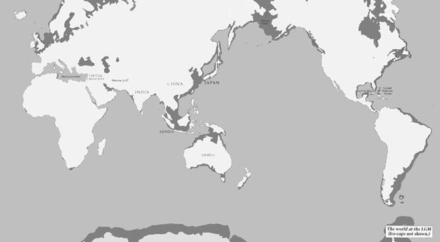
And let's not forget that the earth by this time - 8000 years ago -
has already suffered the consequences of 7000 years of intense volcanism, 7000
years of rising sea-levels and sudden and unpredictable marine floods, 7000
years of continental shelves, land-bridges and islands vanishing beneath the
waves, and 7000 years of spectacular climatic instability. Indeed, the
palaeo-climatological record testifies to all of the following - and much more
- between 15,000 and 8,000 years ago: cold oceans, high winds, mountains of
dust in the atmosphere and wildly unpredictable temperature shifts. (124)
Romuald Schild of the Polish Academy of Sciences cites an abrupt
warming that took place in the northern Atlantic at around 12,700 years ago,
stopped and equally abruptly went into reverse 10,800 years ago - when there
was a sudden 800-year plunge to almost full glacial temperatures - then turned
again to another episode of abrupt warming about 10,000 years ago. Robert
Schoch reports that the bulk of the first warming- 'approximately 27 degrees
Farenheit, a massive increase' - occurred after 11,700 years ago: Remarkably,
the ice-core data suggests that half of the temperature change, in the
neighbourhood of 14 degrees Farenheit, occurred in less than 15 years centering
around 9645 BC.
That's a bigger temperature increase, and faster, than the scariest
doomsday scenario about global warming in the twenty-first century. It also
happens to coincide, almost exactly, with Plato's date of around 11,600 years
ago for the sinking of Atlantis, when, the reader will recall, 'There were
earthquakes and floods of extraordinary violence, and in a single dreadful day
and night ... the island of Atlantis was ... swallowed up by the sea and
vanished.' (124)
During the
same 10,000-year epoch in which the ice melted and global sea-level rose by 120
metres - roughly from 17,000 down to 7000 years ago - our planet also
experienced dramatically increased volcanism, dramatically increased frequency
and magnitude of earthquakes, and a dramatically unstable climate that seesawed
rapidly and unpredictably between extremes. (124)
Nanosized diamonds found just a few meters below the surface of Santa
Rosa Island off the coast of Santa Barbara provide strong evidence of a cosmic
impact event in North America approximately 12,900 years ago, according to a
new study by scientists. Their hypothesis holds that fragments of a comet
struck across North America at that time. The research was led by James
Kennett, professor emeritus at UC Santa Barbara, and Douglas J. Kennett, first
author, of the University of Oregon. The two are a father-son team. They were
joined by 15 other researchers.
"The pygmy mammoth, the tiny island version of the North American
mammoth, died off at this time," said James Kennett. "Since it
coincides with this event, we suggest it is related." He explained that
this site, with its layer containing hexagonal diamonds, is also associated
with other types of diamonds and with dramatic environmental changes and
wildfires. They are part of a sedimentary layer known as the Younger Dryas
Boundary. "There was a major event 12,900 years ago," said James
Kennett. "It is hard to explain this assemblage of materials without a
cosmic impact event and associated extensive wildfires. This hypothesis fits
with the abrupt climatic cooling as recorded in ocean-drilled sediments beneath
the Santa Barbara Channel. The cooling resulted when dust from the
high-pressure, high-temperature, multiple impacts was lofted into the
atmosphere, causing a dramatic drop in solar radiation."
The tiny diamonds were buried below four meters of sediment and they
correspond with the disappearance of the Clovis culture -- the first
well-established and distributed North American peoples. An estimated 35 types
of mammals and 19 types of birds also became extinct in North America about
this time. "The type of diamond we have found is a shock-synthesized
mineral defined by its hexagonal crystalline structure," said Douglas
Kennett, associate professor of anthropology at the University of Oregon.
"It forms under very high
temperatures and pressures consistent with a cosmic impact. These diamonds have
only been found thus far in meteorites and impact craters on earth, and appear
to be the strongest indicator yet of a significant cosmic impact [during
Clovis]." The diamonds were found in association with soot, which forms in
extremely hot fires, and they suggest associated regional wildfires, based on
nearby environmental records. Such soot and diamonds are rare in the geological
record. They were found in sediment dating to massive asteroid impacts 65
million years ago in a layer widely known as the K-T Boundary, known to be
associated with the extinction of dinosaurs and many other types of organisms.
(136)
Africa
The
climatic record is, however, unequivocal: for most of the time between around 14 kya and 5 kya
the Sahara experienced a monsoonal climate. The region had considerably greater
rainfall than now and much of the land had permanent vegetation. (145)
Southwest Asia
Between 13,000 BC and 4000 BC sea levels rose significantly as
ice sheets melted. Meteorologists suggest that there was increased rainfall
in the Near East in this era and botanists point to increased plant life. (68)
By 14,000 yr BP the Hormuz Strait has opened up as a narrow waterway
and the flooding of the lowlands to the west begins, first with the flooding of
the Eastern Basin by marine water soon after 13,000 BP. Marine influence is
first experienced in the Central Basin before about 12,500 BP (124)
MOST RECENT DATE
COMMON NAME GENUS BEFORE PRESENT
COMMON NAME GENUS BEFORE PRESENT
CHEETAH
Acinonyx
17,000
PECCARY Platygonus 13,000
SHORT-FACED BEAR Arctodus 12,600
PRONGHORN Stockoceros 11,300
WOODLAND MUSK OX Symbos 11,100
MAMMOTH Mammuthus 10,500
MASTODON Mammut 10,400
LION Panthera 10,400
HORSE Equus 10,400
CAMEL Camelops 10,300
STAG-MOOSE Cervalces 10,200
GIANT BEAVER Castoroides 10,200
GIANT GROUND SLOTH Glossotherium 9,800
SABERTOOTH Smilodon 9,400
TAPIR Tapirus 9,400
PECCARY Platygonus 13,000
SHORT-FACED BEAR Arctodus 12,600
PRONGHORN Stockoceros 11,300
WOODLAND MUSK OX Symbos 11,100
MAMMOTH Mammuthus 10,500
MASTODON Mammut 10,400
LION Panthera 10,400
HORSE Equus 10,400
CAMEL Camelops 10,300
STAG-MOOSE Cervalces 10,200
GIANT BEAVER Castoroides 10,200
GIANT GROUND SLOTH Glossotherium 9,800
SABERTOOTH Smilodon 9,400
TAPIR Tapirus 9,400
In this list, as in more complete ones, the apparent extinction dates
cluster between 11,000 and 9,500 years ago. This was the time that the climate,
local weather, and ecosystems of North America were undergoing a spectacularly
rapid upheaval. It is also the time when other creatures that could also be
called charismatic megafauna thrived - the hunters of the Clovis culture and
the ensuing Folsom culture. (130)
The
steadily rising sea levels might have had a more profound effect on coastal
communities where large areas were inundated in fits and starts. For example,
this could have happened in the Persian Gulf. This enclosed sea goes no deeper
than 100 m, and much of the seabed is only about 40 m below the present-day
surface. When sea levels were 120 m lower the gulf would have been dry land 20
kya, and the ancestral river system of the Tigris and Euphrates flowed through
the deepest part of the gulf, a canyon cut by the river waters to the Indian
Ocean. The postglacial rise in sea level inundated the floor of the gulf
between 15 and 6 kya. The sea advanced more than 1000 km, forcing any people
living there to abandon their settlements. (145)
The
climatic record is, however, unequivocal: for most of the time between around
14 kya and 5 kya the Sahara experienced a monsoonal climate. The region had
considerably greater rainfall than now and much of the land had permanent
vegetation. (145)
In the New World...more than seventy genera of large mammals became
extinct between 15,000 BC and 8000 BC, including all North American members of
seven families, and one complete order, the Proboscidea. These staggering
losses, involving the violent obliteration of more than forty million animals,
were not spread out evenly over the whole period; on the contrary, the vast
majority of the extinctions occurred in just two thousand years, between 11,000
BC and 9000 BC. To put this in perspective, during the previous 300,000 years
only about twenty genera had disappeared. (152)
Egypt
The climatic record is, however, unequivocal: for most of
the time between around 14 kya and 5 kya the Sahara experienced a monsoonal
climate. The region had considerably greater rainfall than now and much of the
land had permanent vegetation. (145)
Indus Valley
An epoch of spectacular geological turmoil occurred at the end
of the last Ice Age, with the most dramatic effects registered in a
series of cataclysmic floods that took place at intervals between roughly
15,000 and 7000 years ago. Is it an accident that this same 8000-year period
has been pinpointed by archaeologists as the very one in which our supposedly
primitive forefathers made the transition (in different places at somewhat
different times) from their age-old hunter-gatherer lifestyle to settled
agriculture? Or could there be more to 'the food-producing revolution' than
meets the eye?
After all, most scientists already recognize a causative connection
between the end of the Ice Age and the supposed beginning of farming - indeed
an unproven hypothesis that rapid climate changes forced hunter-gatherers to
invent agriculture presently serves as pretty much the sum of conventional
wisdom on this subject.
But there is another possibility. Nobody seems to have noticed that in
the general vicinity of each of the places in the world where the
food-producing revolution is supposed to have begun between 15,000 and 7000
years ago there is also a large area of land that was submerged by the
post-glacial floods between 15,000 and 7000 years ago: We have seen that this
is true for India, one of the world's ancient agricultural 'hearths', which
lost more than a million square kilometres in the south and the west and, most
conspicuously in the north-west, at the end of the Ice Age. (124)

India's coastlines in Reinal map of AD 1510 (above)
India's coastlines in 11,500 BCm (Below)
 1. Today this is the mouth of the Indus river, which is a
delta. But on both Reinal's and Milne's maps, it is marked by a wide gulf.
1. Today this is the mouth of the Indus river, which is a
delta. But on both Reinal's and Milne's maps, it is marked by a wide gulf. 2. A large bulge that in both Reinal's and Milne's maps replaces the Kathiawar peninsula that exists today.
3. An island (or island-group) which is depicted on both maps but which does not exist today.
4. A gulf which on both maps is much smaller than the Gulf of Cambay that exists today.
5. A large island (or island-group) which is depicted on both maps but which does not exist today.
6. An island at the same latitude as the northernmost Lakshadweep island (approximately 12 degrees north) is shown on both Reinal's and Milne's maps. No island exists there today.
7. The Lakshadweep islands, which exist today but which are enlarged in both Reinal's and Milne's maps.
8. The tip of the sub-continent. Both maps show the tip of the sub-continent somewhat like a bay, wide but not deep, facing south-west towards the northern Maldives - very different from the south-east-facing tip that exists today.
9. A tiny island which is depicted on both Reinal's and Milne's maps next to the southern tip of the sub-continent. No island exists there today.
10. The Maldive islands, which exist today but which are enlarged in both Reinal's and Milne's maps.
Between about 30,000 and 10,000 years ago, European climates began a
long cooling trend with some periods of extreme cold, but for most of the
period the summers were cool and the winters relatively mild. The rich European
grasslands and mixed forest habitats supported great numbers of herbivores,
including reindeer, deer, bison, wild ox, ibex, woolly rhinoceros, and
mammoths. France seems to have been densely occupied during this period,
particularly near the confluence of the Dordogne and Vezere rivers. This lovely
part of the world is a well-watered, heavily forested limestone formation,
honeycombed with caves and rock shelters, which offered excellent places to
live.(24)
One of the most amply documented Upper Paleolithic cultures in eastern
Europe is the Kostenski-Bershevo culture centered in the Don River Valley,
about 470 kilometers southeast of Moscow. About 25,000 to 11,000 years ago, the
Kostenski-Bershevo area was an open grassland environment, with no rock
shelters, caves, or other natural habitations, and with very little wood
available for fires. People here left a variety of archeological sites.(24)
At peak moments of the meltdown any hypothetical civilizations living
around the edges of partially enclosed seas that served as drainage areas for
the great ice-sheets could have suffered disproportionately large and rapid
change in sea-level. In a sophisticated and original argument, LaViolette draws
particular attention to the Mediterranean: Glacial meltwater [from the nearby
European ice-sheets] would have entered the Mediterranean much more rapidly
than it could escape through the Straits of Gibraltar, and, as a result, the
temporary rise in Mediterranean sea-level would have been much greater than in
the surrounding oceans ... [Such meltwater surges] could have temporarily
raised the Mediterranean by some 60 meters, flooding all coast civilizations. (124)
…there is no dispute from any authority that during the extremely cold
and arid periods that occurred several times between 17,000 and 10,000 years
ago: man and animals could migrate from the Italian peninsula, by land, to the
warmer climates of the Siculo-Maltese district. Herds of red deer left northern
latitudes and settled in all parts of present-day Sicily, the present-day Egadi
islands of Favignana and Levanzo, and the Maltese archipelago, the latter site
being the warmest of the Siculo-Maltese district during the Pleistocene. (124)
This indicates that mastodons (not arctic animals) were present,
probably in large numbers, in the forests of the United States and Canada as
early as 12,000 years ago. Deglaciation was probably at least 2,000 years
earlier. (132)
In 1931 a trawler working in the southern North Sea dredged up a lump
of peat containing an exquisitely crafted spearhead made from a deer's antler.
Dated as being nearly 14 kyr old, this artefact was dramatic evidence of how
early humans exploited the broad expanses of land that had been exposed during
the last ice age, and were only reclaimed by the sea some 7 kya. When this
spearhead was buried, dense oak forests had yet to spread into the region,
known to archaeologists as 'Doggerland', where now the sea is over 30m deep.
This famous find emphasises that the rise in sea level between about 15 and 5
kya covered up large areas of habitable land that had been exploited by humans
and made movement around the continental margins easier. (145)
...sometime during the eleventh millennium BC in the northern parts of
Siberia literally thousands of animals, mammoths in particular, simply froze to
death. Many were found still standing upright with grass in their mouths and
stomachs, indicating that they had been eating at the moment when their fate
was sealed. Some of those studied revealed that their frozen skin still
contained red blood corpuscles, hinting strongly at the fact that death had
been caused through suffocation, either by water or by gases. It is to be
remembered that, contrary to popular belief, woolly mammoths did not live in
arctic conditions. They inhabited more temperate zones where grasslands and wet
boggy forests prevailed. Hibben estimated that over 40 million animals had died
in the continent of America alone, while many species - such as giant beaver
and sloths, mammoths, mastodons, sabre-tooth cats and woolly rhinoceroses - had
become extinct almost overnight. For him: "The Pleistocene period ended in
death. This is no ordinary extinction of a vague geological period which
fizzled to an uncertain end. This death was catastrophic and all-inclusive . ..
The large animals that had given their name to the period became extinct. Their
death marked the end of an era." (149)
The northern regions of Alaska and Siberia appear to have been the
worst hit by the murderous upheavals between 13,000 and 11,000 years ago. In a
great swathe of death around the edge of the Arctic Circle the remains of
uncountable numbers oflarge animals have been found - including many carcases
with the flesh still intact, and astonishing quantities of perfectly preserved
mammoth tusks. The Alaskan muck in which the remains are embedded is like a
fine, dark- grey sand. Frozen solid within this mass, in the words of Professor
Hibben of the University of New Mexico: lie the twisted parts of animals and
trees intermingled with lenses of ice and layers of peat and mosses...Bison,
horses, wolves, bears, lions...Whole herds of animals were apparently killed
together, overcome by some common power...Such piles of bodies of animals or
men simply do not occur by any ordinary natural means...' At various levels
stone artefacts have been found 'frozen in situ at great depths, and in
association with Ice Age fauna, which confirms that men were contemporary with
extinct animals in Alaska'. (152)
Researchers have confirmed that of the thirty-four animal species
living in Siberia prior to the catastrophes of the eleventh millennium BC -
including Ossip's mammoth, giant deer, cave hyena and cave lions - no less than
twenty-eight were adapted only to temperate conditions.' In this context, one
of the most puzzling aspects of the extinctions, which runs quite contrary to
what today's geographical and climatic conditions lead us to expect, is that
the farther north one goes, the more the mammoth and other remains increase in
number.
Indeed some of the New Siberian Islands, well within the Arctic
Circle, were described by the explorers who first discovered them as being made
up almost entirely of mammoth bones and tusks. The only logical conclusion, as
the nineteenth-century French zoologist Georges Cuvier put it, is that 'this
eternal frost did not previously exist in those parts in which the animals were
frozen, for they could not have survived in such a temperature. The same
instant that these creatures were bereft of life, the country which they
inhabited became frozen. In his survey of the New Siberian Islands, the Arctic
explorer Baron Eduard von Toll found the remains 'of a sabretooth tiger, and a
fruit tree that had been 90 feet tall when it was standing. The tree was well
preserved in the permafrost, with its roots and seeds. Green leaves and ripe
fruit still clung to its branches...At the present time the only representative
of tree vegetation on the islands is a willow that grows one inch high'. ...at
some point between 12-13,000 years ago a destroying frost descended with
horrifying speed upon Siberia and has never relaxed its grip. (152)
11,000 BC Orkney separated from Scotland by rising sea level (160)
South America
Ironically, the site with perhaps the best claim to a pre-12,000 BP
date date in the Americas is among the farthest south, Monte Verde,
in south central Chile. Here Tom Dillehay and his crew have excavated a camp
site that has been radiocarbon-dated to about 13,000 years ago, and below the
levels of that age are layers of tools and debris that may be much older,
perhaps up to 33,000 years old.(26)
A wet period followed [at Lake Titicaca] between 13,000 and 11,000
years ago. (69)
We have two areas lying at similar distances from their respective
poles. In one, the northern, we have many evidences of heavy glaciation,
extending over a period of perhaps 40,000 years, but ending about 14,000 years
ago, to give way to the present climate about 10,000 years ago. In Chile and
Argentina, on the other hand, in the same relative latitude just as close,
presumably, to a pole, we have no glaciation until after the climate has become
normal for the present temperate zone in the north. It appears that in
Argentina a cool period set in just as the hipsithermal phase with higher
temperatures set in all over the northern hemisphere! Clearly, then, there was
no similarity in climatic trends, but rather the opposite. (132)
All around the world there is also overwhelming evidence to show that,
while the old ice-caps were melting, new ones were taking their place. The
continent of Antarctica, for instance, began its gradual glaciation towards the
end of the last Ice Age and was still relatively free of ice in certain regions
right down until 4000 BC. Other evidence indicates that a short relapse, a kind
of mini-ice age, where the ice sheets began advancing once more, occurred in
Europe and Asia Minor sometime between 11,000 to 10,000 years ago. More curious
is evidence from locations as far apart as northern Armenia and the Andean
Altiplano of Bolivia and Peru, not only of the extinction of animals during the
eleventh and tenth millennia BC, but also of dramatic elevations in the
terrain's altitude above sea level. (149)
Dozens and dozens of hulking blocks lay scattered in all directions,
tossed like matchsticks, Posnansky argued, in the terrible natural disaster
that had overtaken Tiahuanaco during the eleventh millennium BC: This
catastrophe was caused by seismic movements which resulted in an overflow of
the waters of Lake Titicaca and in volcanic eruptions... In addition, fragments
of human and animal skeletons had been found lying in chaotic disorder among
wrought stones, utensils, tools and an endless variety of other things. All of
this has been moved, broken and accumulated in a confused heap. Anyone who
would dig a trench here two metres deep could not deny that the destructive
force of water, in combination with brusque movements of the earth, must have
accumulated those different kinds of bones, mixing them with pottery, jewels,
tools and utensils...(152)
North America
...the drumlins and other 'hummocky' landforms strewn across
Canada are evidence of continental floods of biblical
proportions - floods of water in some cases hundreds of metres high - that
roared out from beneath the ice-caps during the last deglaciation, destroying
or mangling everything in their path. Shaw explicitly suggests that many elements
of the universal myth of the deluge may be explained by such floods pouring
down off the land - intimately linked, as they were, to the episodes of sudden
and ferocious sea-level rise that took place between 15,000 and 8000 years ago.
I think it is worth re-emphasizing Shaw's figures, and their implications. He
is talking about turbulent, energetic floods 20 metres deep flowing in vortices
at high speed and pressure, under the main ice-sheets, across fronts up to 160
kilometres wide. Only floods on such a scale and of such violence could have
sculpted the drumlin-fields and hummocky terrain and tortured pitted scablands
of Canada and the United States and carved out other remarkable features such
as the extremely large through valleys - including those containing the Finger
Lakes - that lie to the south of drumlin-fields in northern New York State.
'Volumes of water required to sustain such floods', observes Shaw, 'would have
been of the order of one million cubic kilometres equivalent to a rise of several
metres in sea-level over a matter of weeks. (124)
Today, Eskimos using skin boats easily cross the ninety kilometers of
open sea separating Siberia and America, and recently an American woman
slathered herself with grease and actually swam from Alaska to Siberia. But
such a sea crossing would not have been necessary during much of the
Pleistocene. During periods of glacial advance within the last million years,
enourmous quantities of water were converted to ice, lowering the sea level
sufficiently to expose a 1500- to 3000-kilometer-wide expanse of the floor of
the Bering Sea. This land bridge--usually referred to as Beringia--was probably
available at least four times in the last 60,000 years.(25)
Prior to 10,000 years ago, species of deer, bison,camels, bears,
foxes, mammoths, moose, caribou,and even rodents crossed from Siberia into the
New World. Going in the other way--from America to Asia--were foxes,
woodchucks, and, during the early Pliestocene, the ancestors of modern forms of
horses, wolves, and other animals.(25)
One might think that good, solid archaeological data--bones and
stones--would be a firmer basis for analyzing New World colonization, given the
ambiguities in estimating rates of change in teeth, languages, etc. The truth,
however, is that the archaeological record does not resolve these questions and
disputes about the date, routes, and adaptations of the first Americans. At
this time there is no conclusive evidence that people were in the New World and
south of Alaska before about 13,000 BC. That they were there at that time or
shortly thereafter is certain (insofar as science can ever be certain), since
scores of sites have been dated by many different methods to between 13,000 and
10,000 BC.(26)
A controversial new idea suggests that a large space rock exploded over
North America 13,000 years ago.
The blast
may have wiped out one of America's first Stone Age cultures as well as the continent's big
mammals such as the mammoth and the mastodon. The blast, from a comet or
asteroid, caused a major bout of climatic cooling which may also have affected
human cultures emerging in Europe and Asia.
The evidence
comes from layers of sediment at more than 20 sites across North America. These
sediments contain exotic materials: tiny spheres of glass and carbon,
ultra-small specks of diamond - called nanodiamond - and amounts of the rare
element iridium that are too high to have come from Earth.
All, they
argue, point to the explosion 12,900 years ago of an extraterrestrial object up
to 5km across. No crater remains, possibly because the Laurentide Ice Sheet,
which blanketed thousands of sq km of North America during the last Ice Age,
was thick enough to mask the impact. Another possibility is that it exploded in
the air.
The rocks
studied by the researchers have a black layer which, they argue, is the
charcoal deposited by wildfires which swept the continent after the explosion.
The blast would not only have generated enormous amounts of heat that could
have given rise to wildfires, but also brought about a period of climate
cooling that lasted 1,000 years - an event known as the Younger Dryas.
Professor
James Kennett, from the University of California in Santa Barbara (UCSB), said
the explosion could be to blame for the extinction of several large North
American mammals at the end of the last Ice Age. "All the elephants,
including the mastodon and the mammoth, all the ground sloths, including the
giant ground sloth - which, when standing on its hind legs, would have been as
big as a mammoth," he told the BBC. "All the horses went out, all the
North American camels went out. There were large carnivores like the
sabre-toothed cat and an enormous bear called the short-faced bear."
According to
the new idea, the comet would have caused widespread melting of the North
American ice sheet. The waters would have poured into the Atlantic, disrupting
its currents. This, they say, could have caused the 1,000 year-long Younger
Dryas cold spell, which also affected Asia and Europe.
The Younger
Dryas has been linked by some researchers to changes in the living patterns of
people living in the Middle East which led to the beginning of farming.(29)
We have two areas lying at similar distances from their respective
poles. In one, the northern, we have many evidences of heavy glaciation,
extending over a period of perhaps 40,000 years, but ending about 14,000 years
ago, to give way to the present climate about 10,000 years ago. In Chile and
Argentina, on the other hand, in the same relative latitude just as close,
presumably, to a pole, we have no glaciation until after the climate has become
normal for the present temperate zone in the north. It appears that in
Argentina a cool period set in just as the hipsithermal phase with higher
temperatures set in all over the northern hemisphere! Clearly, then, there was
no similarity in climatic trends, but rather the opposite. (132)
Among the largest catastrophic meltwater pulses from Lake Agassiz into
the North Atlantic were those at 12.9 kya (9500k cu. m), 11.3 kya (9300k cu.
m), and 8.2 kya (163000k cu. m). These outbursts coincide with the start of the
Younger Dryas, the Preboreal Oscillation, and the 8.2 kya event, suggesting
that outbursts from Lake Agassiz may have repeatedly influenced hemispheric
climate by affecting the circulation of the North Atlantic. This, in turn,
altered the temperature of the surface of much of the northern North Atlantic,
and with it the climate of much of the northern hemisphere. (145)
...sometime during the eleventh millennium BC in the northern parts of
Siberia literally thousands of animals, mammoths in particular, simply froze to
death. Many were found still standing upright with grass in their mouths and
stomachs, indicating that they had been eating at the moment when their fate
was sealed. Some of those studied revealed that their frozen skin still
contained red blood corpuscles, hinting strongly at the fact that death had
been caused through suffocation, either by water or by gases. It is to be
remembered that, contrary to popular belief, woolly mammoths did not live in
arctic conditions. They inhabited more temperate zones where grasslands and wet
boggy forests prevailed. Hibben estimated that over 40 million animals had died
in the continent of America alone, while many species - such as giant beaver
and sloths, mammoths, mastodons, sabre-tooth cats and woolly rhinoceroses - had
become extinct almost overnight. For him: "The Pleistocene period ended in
death. This is no ordinary extinction of a vague geological period which
fizzled to an uncertain end. This death was catastrophic and all-inclusive . ..
The large animals that had given their name to the period became extinct. Their
death marked the end of an era." (149)
The northern regions of Alaska and Siberia appear to have been the
worst hit by the murderous upheavals between 13,000 and 11,000 years ago. In a
great swathe of death around the edge of the Arctic Circle the remains of
uncountable numbers oflarge animals have been found - including many carcases
with the flesh still intact, and astonishing quantities of perfectly preserved
mammoth tusks. The Alaskan muck in which the remains are embedded is like a
fine, dark- grey sand.
Frozen solid within this mass, in the words of Professor Hibben of the
University of New Mexico: lie the twisted parts of animals and trees
intermingled with lenses of ice and layers of peat and mosses...Bison, horses,
wolves, bears, lions...Whole herds of animals were apparently killed together,
overcome by some common power...Such piles of bodies of animals or men simply
do not occur by any ordinary natural means...' At various levels stone artefacts
have been found 'frozen in situ at great depths, and in association with Ice
Age fauna, which confirms that men were contemporary with extinct animals in
Alaska'. (152)
There is a remarkable amount of evidence of excessive volcanism during
the decline of the Wisconsin ice cap. Far to the south of the frozen Alaskan
mucks, thousands of prehistoric animals and plants were mired, all at once, in
the famous La Brea tar pits of Los Angeles. Among the creatures unearthed were
bison, horses, camels, sloths, mammoths, mastodons and at least seven hundred
sabre-toothed tigers. A disarticulated human skeleton was also found,
completely enveloped in bitumen, mingled with the bones of an extinct species
of vulture. In general, the La Brea remains ('broken, mashed, contorted, and
mixed in a most heterogeneous mass') speak eloquently of a sudden and dreadful
volcanic cataclysm. The bulk of the animal extinctions took place between
11,000 BC and 9000 BC when there were violent and unexplained fluctuations of
climate. (152)
Other
Around modern Malaysia, Indonesia and the Philippines, and
stretching as far north as Japan, lay the endless plains of 'Sunda Land', a
fully fledged antediluvian continent. It was submerged very rapidly some time
between 14,000 and 11,000 years ago. (124)
…until as recently as 6000 years ago, as I was to discover when I
received Glenn Milne's inundation maps for the region in the summer of 2001,
Bimini remained part of a large antediluvian island lying across the Gulf
Stream from Florida. Very close to the north-western tip of this palaeo-island,
overlooking the Gulf Stream then as they do today, were what is now Paradise
Point and the present site of the Bimini Road. (124)

The inundation map for 12,400 years ago shows, to the north, a
crescent-shaped island around present-day Grand Bahama, Great Abaco and Little
Abaco. Clockwise to the south-east from there we come to a second lost island.
This island fills in what is now Tarpum Bay under Eleuthera, then connects via
the thin but very probably unbroken line of the Exuma Cays to an even larger
exposed area stretching almost as far south as Cuba - itself significantly
larger than it is today. Third, to the north-west in the direction of the
Florida peninsula covering present-day Andros island and occupying most of the
Great Bahama Bank, is the largest antediluvian island of all, with Bimini and
the Bimini Road right at its tip.

The inundation map for 6900 years ago shows some coastal erosion of
the three main islands but otherwise the picture remains basically unchanged -
indicating that the islands survived beyond the last of the three great
episodes of global postglacial flooding around 7000 years ago.

However, in the next inundation map in the sequence, for 4800 years
ago, all the islands have gone. The most likely culprit for their inundation is
the so-called Flandrian transgression, the final spasm of the Ice Age meltdown,
which took place between 6000 and 5000 years ago. (124)
…the 1424 Venetian chart does not portray Taiwan and Japan as they
looked in the early fifteenth century, the epoch of Cheng Ho's voyages, but as
they looked around 12,500 years ago during the meltdown of the Ice Age. One
would have to go back to around that date, for example, to find the three main
Japanese islands - Honshu, Shikoku and Kyushu - joined together into one larger
island, as is the case with Satanaze. (124)
All around the world there is also overwhelming evidence to show that,
while the old ice-caps were melting, new ones were taking their place. The
continent of Antarctica, for instance, began its gradual glaciation towards the
end of the last Ice Age and was still relatively free of ice in certain regions
right down until 4000 BC. Other evidence indicates that a short relapse, a kind
of mini-ice age, where the ice sheets began advancing once more, occurred in
Europe and Asia Minor sometime between 11,000 to 10,000 years ago. More curious
is evidence from locations as far apart as northern Armenia and the Andean
Altiplano of Bolivia and Peru, not only of the extinction of animals during the
eleventh and tenth millennia BC, but also of dramatic elevations in the
terrain's altitude above sea level. (149)
Some 260 million years ago, during the Permian period, deciduous trees
adapted to a warm climate grew in Antarctica. ...Here at the southernmost known
mountain in the world, - scarcely two hundred miles from the South Pole, was
found conclusive evidence that the climate of Antarctica was once temperate or
even sub-tropical. ...sedimentary cores collected from the bottom of the Ross
Sea by one of the Byrd Antarctic Expeditions provide conclusive evidence that
'great rivers, carrying down fine well grained sediments' did flow in this part
of Antarctica until perhaps as late as 4000 BC. From 6000 to 15,000 years ago
the sediment is fine-grained with the exception of one granule at about 12,000
years ago. This suggests an absence of ice from the area during that period,
except perhaps for a stray iceberg 12,000 years ago. ...at one time the temperatures
of the Arctic Ocean were similar to the contemporary temperatures of the Bay of
Bengal or the Caribbean Sea. (152)
From Human Past @ http://humanpast.net/environment/environment11k.htm [Referencing Underworld by Graham Hancock]
For more information about the great flood see http://nexusilluminati.blogspot.com/search/label/great%20flood
- See ‘Older Posts’ at the end of each section
This is a ‘not for
profit’ site -
But if you like what we do please
buy us a meal or drink if you can
Donate any amount and receive at least one New Illuminati eBook!
Please click below -
Xtra Image – http://farm9.staticflickr.com/8366/8358109706_6dd77fdf6c_h.jpg
Video - http://www.youtube.com/watch?v=D1_jTTP42TM&feature=share&list=PL719F1B673F805E98
Video - http://www.youtube.com/watch?v=D1_jTTP42TM&feature=share&list=PL719F1B673F805E98
For further enlightening
information enter a word or phrase into the random synchronistic search box @ http://nexusilluminati.blogspot.com
And see
New Illuminati – http://nexusilluminati.blogspot.com
New Illuminati on Facebook - https://www.facebook.com/the.new.illuminati
New Illuminati Youtube Channel - http://www.youtube.com/user/newilluminati/feed
New Illuminati on Google+ @ https://plus.google.com/115562482213600937809/posts
New Illuminati on Twitter @ www.twitter.com/new_illuminati
The Her(m)etic Hermit - http://hermetic.blog.com
The Prince of Centraxis - http://centraxis.blogspot.com (Be Aware! This link leads to implicate &
xplicit concepts & images!)
DISGRUNTLED SITE ADMINS PLEASE NOTE –
We provide a live link to your original material on your site - which
raises your ranking on search engines and helps spread your info further! This site
is published under Creative Commons Fair Use Copyright (unless an individual article
or other item is declared otherwise by copyright holder) – reproduction for non-profit
use is permitted & encouraged, if you give attribution to the work &
author - and please include a (preferably active) link to the original (along
with this or a similar notice).
Feel free
to make non-commercial hard (printed) or software copies or mirror sites - you
never know how long something will stay glued to the web – but remember
attribution! If you like what you see, please send a donation (no amount is too
small or too large) or leave a comment – and thanks for reading this far…
Live long
and prosper!
From the New
Illuminati – http://nexusilluminati.blogspot.com


